Vodafone and OHLA revolutionise urban green space management with geospatial technology and artificial intelligence
At MWC 2023, Vodafone presented a pioneering solution that uses geospatial technology and artificial intelligence to optimise the management of urban green spaces.
The Internet of Things (IoT) project has been driven by Ingesan, Services subsidiary of the global infrastructure group OHLA, and has also had the collaboration of GeoAIT, a company specialising in geospatial technology and artificial intelligence, and Maxar, a leading American company in satellite photography, which owns and operates the most sophisticated constellation of images of the Earth in orbit, collecting more than 3.8 million square kilometres of high-resolution satellite images every day.
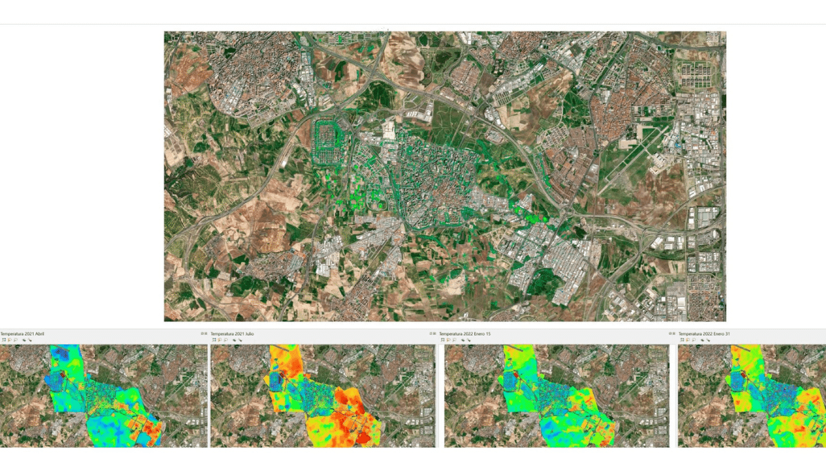
The VerSat platform, designed by the OHLA subsidiary, uses high-resolution satellite imagery to detect areas of improvement and support the decision, design, implementation and monitoring of urban climate mitigation actions and ecosystem indicators. The tool is being studied and analysed by the Chair of Circular Economy at the Rey Juan Carlos University in Madrid.
A pioneering solution to combat climate change
The conservation of urban green spaces is essential in the fight against climate change and, being more and more aware of this challenge, local administrations are increasingly striving to optimise maintenance works, maximising the performance of work teams and ensuring a correct allocation of the natural, human and material resources necessary for their proper conservation.
Combining Artificial Intelligence and the most advanced geospatial technology with high-resolution satellite photographs, the solution is capable of making an inventory of the tree mass with an estimated accuracy of 95%.
In addition, these satellites use infrared sensors to collect information beyond the visible spectrum, which provides a deeper understanding of everything that is happening in a given area, making it possible to classify crop types, identify the state of health of the plants, detect diseases and pests, know their water stress to manage irrigation levels, etc. In this way, more than 30 vegetative, biochemical and biophysical indices are obtained, as well as spectral signatures that classify the health of the vegetation, categorise natural matter, penetrate smoke and detect fires or map minerals, among other functionalities.
All this information, analysed as part of an IoT solution, enables parks and gardens teams to make the best decisions when allocating resources for green space maintenance. This optimises available resources and contributes to more efficient resource management.


